Civil 3D has traditionally sat at the detailed engineering end of Autodesk’s infrastructure workflow.
Planning context may come from GIS, survey data, Revit, InfraWorks, or other project sources, but civil engineers usually bring that information together inside Civil 3D before developing alignments, profiles, corridors, surfaces, pipe networks, and construction documentation.
Autodesk is now changing how those environments connect.
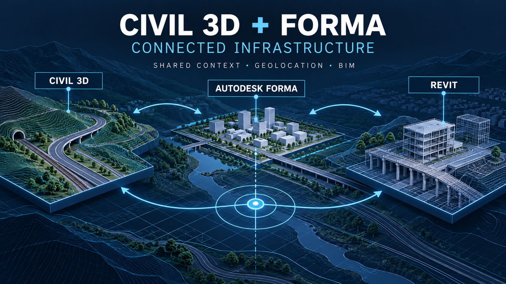
At Autodesk University 2026, Autodesk announced that Civil 3D will become the next Forma Connected Client, following Revit.
The goal is not to replace Civil 3D with a cloud application.
Instead, Autodesk plans to connect Civil 3D more directly to the Forma industry cloud so civil engineers can continue detailed engineering while working with shared project context from Forma and Revit.
This announcement also arrives just one week after Autodesk made the Civil 3D Cloud Connector for Data Exchange generally available, making it important to understand what is available now and what is still coming.
Quick Answer
Civil 3D is becoming a Forma Connected Client.
Autodesk says the first implementation will begin as a Technology Preview focused on reference-based interoperability between Civil 3D, Forma, and Revit.
A more consistent geolocation approach is intended to reduce manual transformations and model misalignment between applications.
This should not be confused with the Civil 3D Cloud Connector for Autodesk Data Exchange, which became Generally Available on September 8, 2026.
The Cloud Connector is available today.
The broader Civil 3D Forma Connected Client workflow announced at AU 2026 is the next step.
What Is a Forma Connected Client?
Autodesk uses the term Forma Connected Client for desktop applications that are deeply connected to the Forma industry cloud.
The concept allows users to continue working inside specialized desktop applications while using cloud data, project context, analysis, and shared workflows from Forma.
For Civil 3D, Autodesk says the initial Technology Preview will introduce reference-based interoperability with Forma and Revit.
Civil engineers will be able to connect to Forma, reference planning and building designs inside the Civil 3D environment, and continue detailed engineering with that project context around their work.
Civil 3D information can also contribute to shared project context so other disciplines have better visibility into the civil design.
Why This Matters for Infrastructure BIM
Infrastructure coordination is unusually sensitive to location.
Civil engineering projects routinely depend on:
- survey coordinates
- GIS systems
- large real-world coordinate values
- terrain
- road geometry
- utilities
- property data
- alignment stationing
- vertical datums
When Civil 3D, Revit, GIS, and planning applications use different coordinate assumptions, teams may spend considerable time translating, rotating, moving, or validating models.
Autodesk says a unified geolocation engine and workflow across Forma, Revit, and Civil 3D is intended to keep project location more consistent as teams move between applications.
This may become one of the most practically important parts of the Connected Client direction.
The value is not simply cloud connectivity.
It is reducing the amount of manual coordination required to confirm that every discipline is working in the same physical location.
What Is Already Available Today?
There is an important distinction between the upcoming Connected Client workflow and Autodesk Data Exchange.
On September 8, 2026, Autodesk announced that the Civil 3D Cloud Connector had moved from Public Beta to Generally Available.
It allows teams to create Autodesk Data Exchanges from Civil 3D information and bring civil data into connected Autodesk workflows.
Autodesk currently documents support for infrastructure information including:
- corridors
- pipe networks
- surfaces
- alignments
- profiles
- corridor solids
The connector also supports geolocation-aware exchanges and Property Set data.
This gives other teams access to selected civil information without requiring them to work directly with the complete Civil 3D DWG.
Civil 3D Data Exchange Is Not the Same as Forma Connected Client
These technologies are related, but they are not identical.
The Civil 3D Cloud Connector primarily solves a data-sharing problem.
A Civil 3D team can expose relevant model data through Data Exchange so downstream teams can consume the required civil geometry and properties.
The Forma Connected Client concept is broader.
It is intended to connect Civil 3D more directly to shared Forma context and workflows.
| Technology | Current Status | Main Purpose |
|---|---|---|
| Civil 3D Cloud Connector | Generally Available | Share selected Civil 3D data through Autodesk Data Exchange |
| Civil 3D Forma Connected Client | Announced / Tech Preview planned | Connect Civil 3D to Forma and Revit project context |
| Forma Street Design | In development / Closed Beta waitlist | Early-stage street design before detailed Civil 3D engineering |
This distinction is critical.
Teams should not assume that every workflow shown in the AU 2026 Connected Client announcement is available in production Civil 3D today.
What Changed With the Civil 3D Cloud Connector GA Release?
The generally available release is already meaningful for multidisciplinary infrastructure coordination.
Autodesk says geolocation-aware exchanges can keep Civil 3D and Revit information aligned in real-world coordinates.
Civil-specific Property Set information can travel with geometry.
Corridor solids can be generated automatically as part of an exchange, removing a manual export step.
The GA release also addressed workflow gaps identified during beta, including better solid property support and layer filtering behavior.
This provides an alternative to repeatedly exporting complete DWGs or intermediate solids simply to provide reference context to other disciplines.
A More Practical Civil 3D-to-Revit Workflow
One of the strongest current use cases is giving Revit teams civil context.
A building or structural team may need to understand:
- site grades
- roads
- utilities
- corridor geometry
- underground infrastructure
- nearby civil design constraints
Historically, this often involved exporting a DWG or another reference format from Civil 3D and then maintaining that reference inside Revit.
With Data Exchange, a civil team can expose the relevant data while downstream users consume the required infrastructure context.
The benefit is not that file-based workflows disappear overnight.
The important shift is toward sharing the required project information rather than transferring an entire authoring file every time.
Why Geolocation Is the Bigger Story
Civil 3D-to-Revit interoperability has never been only a geometry problem.
Two models can contain the correct shapes and still fail coordination because:
- coordinate systems differ
- units are interpreted differently
- shared coordinates are not established
- GIS transformations are involved
- rotations differ
- vertical datums differ
- one model uses project coordinates while another uses real-world coordinates
Autodesk’s Connected Client announcement specifically highlights a unified geolocation approach across Forma, Revit, and Civil 3D.
If implemented reliably, this could reduce one of the most persistent sources of infrastructure BIM coordination friction.
It does not mean coordinate validation will disappear.
Survey control, project datums, GIS references, and engineering requirements will still require professional verification.
But reducing application-specific transformations could make the workflow significantly easier to manage.
Until these connected geolocation workflows mature, teams still need to understand how shared coordinates behave between Civil 3D and Revit.
Where Does Forma Street Design Fit?
Autodesk also introduced Forma Street Design at AU 2026.
This is a cloud-based early-stage street design application intended for civil engineers and transportation planners.
Autodesk says users can work with real parametric geometry rather than a simple visual sketch.
Announced capabilities include:
- alignment editing
- curve-radius adjustment
- lane-width changes
- grade changes
- automatic intersection generation
- swept-path analysis powered by Autodesk Vehicle Tracking
- synchronized plan and section workflows
- GIS and terrain context
Once an early design direction is selected, Autodesk intends for the design to continue into Civil 3D for detailed engineering.
This creates a potentially useful division of work:
Forma Street Design → rapid early optioneering
Civil 3D → detailed engineering
Is Forma Street Design an AI Road Designer?
No.
This distinction matters because Autodesk is announcing many AI-related capabilities at the same time.
Autodesk explicitly says there is no AI in the Street Design workflow itself.
The geometry is parametric and user-controlled.
Forma Board may use AI-powered rendering for stakeholder visualization, but that is separate from the engineering geometry workflow.
What Could the Future Workflow Look Like?
A future infrastructure workflow could increasingly resemble:
GIS / Survey / Site Context
↓
Autodesk Forma
↓
Forma Street Design
↓
Civil 3D
↕
Revit
↓
Shared Project Data / Data Exchange
The important change is that information may not need to be recreated at every transition.
The goal is to preserve project context as teams move from planning into detailed engineering and then across disciplines.
Does This Mean Civil 3D Is Moving to the Browser?
Not based on Autodesk’s current announcement.
Autodesk explicitly states that Civil 3D remains critical for detailed infrastructure engineering and that it will continue investing in the product.
The Connected Client strategy is intended to connect Civil 3D to Forma rather than immediately replace Civil 3D with a browser application.
Forma may take on more planning, shared context, analysis, and collaboration workflows over time.
Civil 3D remains the detailed engineering environment for the workflows discussed in the current announcement.
What Should Civil 3D Teams Do Now?
Infrastructure teams do not need to redesign their entire workflow because of the AU 2026 announcement.
The practical first step is to understand the technologies separately.
Teams working across Civil 3D and Revit can evaluate the now-generally-available Civil 3D Cloud Connector and Data Exchange workflow.
Teams interested in early-stage street design can follow the Forma Street Design closed beta.
Teams following Autodesk’s longer-term platform direction should watch for the Civil 3D Forma Connected Client Technology Preview.
For production projects, coordinate validation and established QA procedures should remain in place regardless of how much of the exchange workflow becomes automated.
What This Means for BIM Managers
For BIM managers, the announcement suggests that interoperability is moving away from complete file exchange and toward shared, reference-based project context.
Instead of asking:
Which file should we export?
the future question may increasingly become:
Which project data should this discipline reference?
That is a meaningful change.
Civil models can be large, specialized, and full of information that another discipline does not need.
Sharing the required subset while maintaining spatial context can reduce duplication and make cross-discipline coordination easier.
Final Takeaway
Civil 3D becoming a Forma Connected Client is more important than another cloud-integration announcement.
It signals Autodesk’s attempt to connect detailed civil engineering with planning, building design, geospatial context, and cloud project data through a more consistent environment.
Some of that future is already visible.
The Civil 3D Cloud Connector is now generally available.
Forma Street Design is in development with a closed-beta waitlist.
Civil 3D’s broader Forma Connected Client integration is planned to begin as a Technology Preview.
The key for infrastructure teams is to separate what is available today from what Autodesk is building next.
Civil 3D is not disappearing.
Autodesk is trying to make it a more connected part of a wider infrastructure BIM ecosystem.
Related: Civil 3D 2027.1 Autodesk Assistant: What Can It Actually Do?
Official Sources
- Civil 3D: The Next Forma Connected Client — Autodesk AEC Tech Drop
- Civil 3D Data Exchange Directly from Autodesk Forma — Now Generally Available — Autodesk Platform Services
- Introducing Forma Street Design: Design Live. Decide Sooner. — Autodesk Forma
- How Autodesk Forma and AI Are Advancing a More Connected Future for AEC — Autodesk News
- Autodesk University 2026 Product Announcements — Autodesk